|
 DvC1-07 (ST26 "O" Sand Spinning CIO - Frame #1) DvC1-07 (ST26 "O" Sand Spinning CIO - Frame #1)
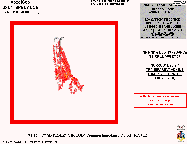
Figure DvC1-07 shows the first frame of an ST-26 "O" Sand Reservoir animation (see Multi Media Animation #1). The reservoir CIO shown, fairly opaque, in red and yellow, and is interpreted to represent both known (and D3D-predicted) recoverable oil and gas (mostly opaque yellow and translucent red, up-dip to the north) and residual oil (pink, even more translucent), unrecoverably left behind by decades of active production. The northern edge of the yellow-red-pink "O" sand CIO terminates up-dip onto the billion-barrel, Bay Marchand (salt-cored-anticline) field. A number of wells have been drilled, over the past few years, along this northern edge of the D3D-imaged "O" sand, with drill sites based on conventionally processed seismic and detailed subsurface and engineering maps (not based on these D3D images), and some wells logged "O" sand facies. These logged "O" pay sand reservoirs are presently of unknown size. Although there are approximately 100 wells drilled into this middle-Miocene, high-GOR oil and gas sand, this D3D-impedance movie only shows the location of three wells:
D22st (the first "infill" well, discussed in Figures DvC1-05 and DvC1-10),
D31 (an "infill" well, discussed in Figure DvC1-13), and
D32 (not discussed, but this well found deeper "O12" and "O16" gas sands,
as shown in DvC1-09).
In this movie, the "O" (Reservoir D) sand is shown in varying states of opacity, spinning around an arbitrary vertical axis, surrounded by transparent, non-O-sand-reservoir VOXELs. Yellow VOXELs are the lowest D3D-impedance and the map-view image in (the upper-right corner of) Figure DvC1-08, shows that many opaque yellow VOXELs are situated BETWEEN producing and water-injector wells, all along the south half of this D3D-CIO. This strongly suggests that, when these seismic data were shot (1996), these areas may have contained bypassed pay in the "O" sand. As of this date (11/04) no wells have been drilled to test these low-impedance, in-fill targets. The vertical "strips" seen in the northern half of the reservoir, are caused by normal faults, picked on numerous well logs. The gaps and "holes" along the southern boundary are log-confirmed shale-out zones, where the "O" sand facies has changed from sandstone to higher impedance, shale or siltstone.
The 72-frame, spinning movie may be viewed by touching the "Multimedia Animations" button on the VTV Home Page. The ST-26 "O" sand movie is the first of the three (D3D-impedance VoxelGeo) movies presented.
|

